Archives

eBird Counties of Southern Alberta

Posted by Bob Lefebvre

If you are a birder in the Calgary area who uses eBird, you may be confused about where the boundaries for the eBird Counties are. As you enter sightings from various locations in the region, you will see that some are assigned to Calgary County, and some to Drumheller, Banff, Lethbridge, or others. It is not clear at first what these counties represent. Even when we were doing the 2015 eBird Competition we were not sure what to make of the eBird Counties.

It turns out that the boundaries for eBird Counties in Canada follow the federal government’s Census Geographic Units. This is not a well-known political or geographic entity, and the boundaries are not marked anywhere as you travel around. (In the United States, where eBird started, the eBird Counties are the same as the political Counties, which are well-known and have well-marked boundaries.)

However, it is possible to see a map of our County boundaries by going on Google Earth. If you don’t have Google Earth you should download it. It is free, and very useful for birders. You can see satellite maps of the entire world down to a very fine level.

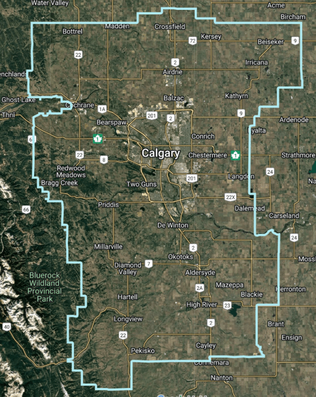
When you are on Google Earth, zoom into the region you want to see, and turn off all the layers except “Borders.” The fine green lines on the map are the county boundaries. (Thanks to Dan Arndt for finding out what the counties are, and how to see the boundaries.)

Southern Alberta, showing eBird County boundaries in green.

Southern Alberta, with eBird County names in yellow and boundaries in green.

Feel free to copy this map as a reference, but I do recommend downloading Google Earth, so you can zoom in to see the boundaries at a finer scale. You can also turn on other layers such as “Places ” and “Roads” so you can see where the towns and highways are.

Below are four detail maps of the north, east, south, and west edges of Calgary county.

The north end of Calgary County.

The east side of Calgary County, along the Trans-Canada Highway. Drumheller County begins immediately east of Weed Lake, and actually includes part of Dalemead Reservoir.

The south end of Calgary County.

The west side of Calgary county.

The eBird Counties do not correspond well to any particular geographic birding region. Many of you may keep track of sightings within the 80-km circle centered on the Centre Street Bridge in Calgary, which is used for the annual May Species Count (and for both the 2005 and 2015 birding competitions). Here is the relevant map for that:

The 80-km circle of the Calgary birding region (red), with eBird Counties in green.

If anyone would like to be able to draw the 80-km circle on Google Earth on their own computer, just email me at birdscalgary@gmail.com and I will give you instructions.

Tonight, Wednesday February 8, 2017, Mike Harrison will speak at the Bird Study Group of Nature Calgary on The Ins and Outs of eBird. If you are an eBird user or want to learn about it, please come out. See this page for details.

Birding App Review – Birdlog for Android

Posted by Dan Arndt

Note: This review is for Birdlog version 1.05. As apps mature and are upgraded to newer versions, some features may change for the better or worse, and new bugs may arise or be removed.

I’ve long been a fan of technology, and while I’ve only seriously been using eBird since January, there are so many times in the field that I had wished I’d been able to just post my exact location and what I saw there right to eBird, without having to stop, take notes, and try to remember where exactly this pond or that grove of trees was. I’ve got a bit of a talent for spotting locations using satellite or aerial photos, but remembering the exact time of day, all the assorted additional species around (and numbers), can be a bit of a task.

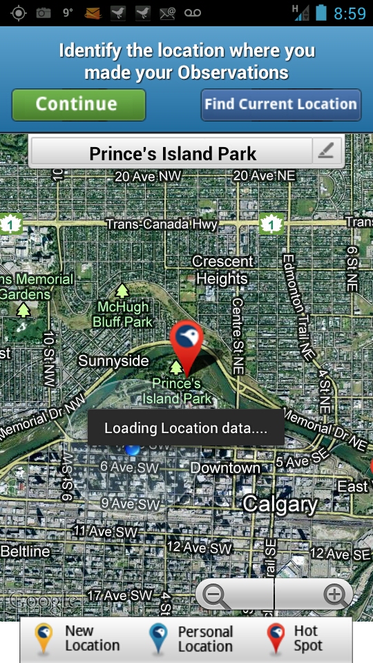
My wishes were granted when BirdLog was released for Android (along with iPhone, and iPad apps, if those are more your style) by Birds In The Hand LLC. Right from the App, you can find your location down to incredible precision using the GPS, which uses satellite photos from Google Maps.

Current GPS Location

Current GPS Location

Nearby eBird Hotspot

Nearby eBird Hotspot

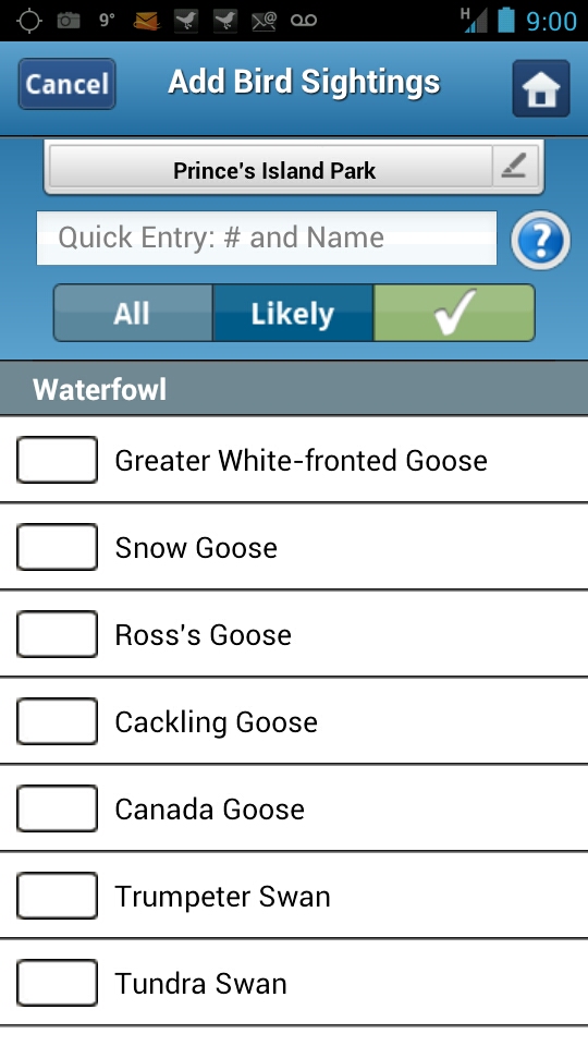
From there, you can enter in the time you started your observations, and the list is sorted taxonomically, and split between the Likely birds in my area, to All reportable birds in my area, and lastly, by the birds actually seen in the report.

Likely Birds List

Likely Birds List

Every time I turn around, I am again amazed at what this thing can do. In the search bar, you can search for the bird species instead of scrolling through the list by name (Red-breasted Nuthatch), or banding code (RBNU), which saves a whole ton of time if you’re trying to record numbers in real time, while also lifting your binoculars or camera to try to get your eyes on the bird itself.

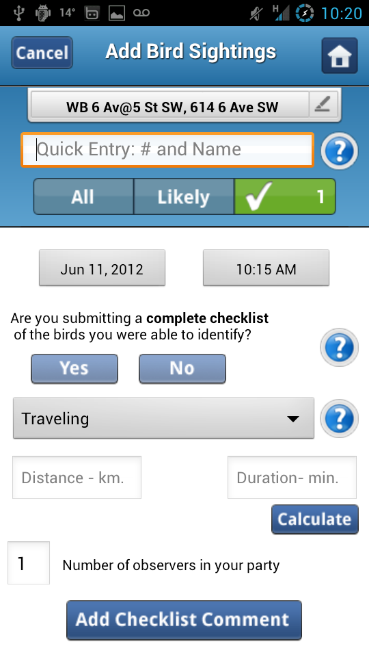
Lastly, before finalizing the list, submit the usual questions eBird uses to document the time, effort, and species data. How long it took, how the observation was made (Travelling, Stationary, or Incidental) along with distance covered, the number of observers in the party, and whether you’re listing all the birds you identified, or only a few species present. You can then choose to save it (in case you want to review it again before submitting to eBird) or just send it right there in the field, or from the pub, after you’ve stopped for your post-birding libations after recording your first ever sighting of your most recent life-bird observation.

Time and Effort Data

Time and Effort Data

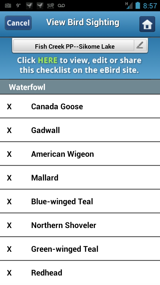
Once you’ve submitted a checklist to eBird, if you decide you want to go back and view the list again, or make any changes to it, you’re greeted with this happy little screen, and a link to where you can edit the data on the eBird website.

Review

Review

And I was just getting into the habit of keeping a field notebook too…