By Andrew Hart
In the new year there will be an eBird challenge in Calgary in which participants try to see as many species as they can within the city limits. See this post for information about the challenge. To join, send your name, ebird name, and email address to Howard Heffler at: hheffler[at]shaw.ca.
It is usually easy to tell if the spot where you are birding or have birded is inside the city limits, particularly if your location is an existing eBird HotSpot. But if you are near the city boundary and birding at a new location, it can be difficult to tell if the spot is inside or outside the city.
There are two mapping tools available to help with this aspect of the challenge. Each tool works on both a desktop and a tablet/smartphone.
Google Maps Tool
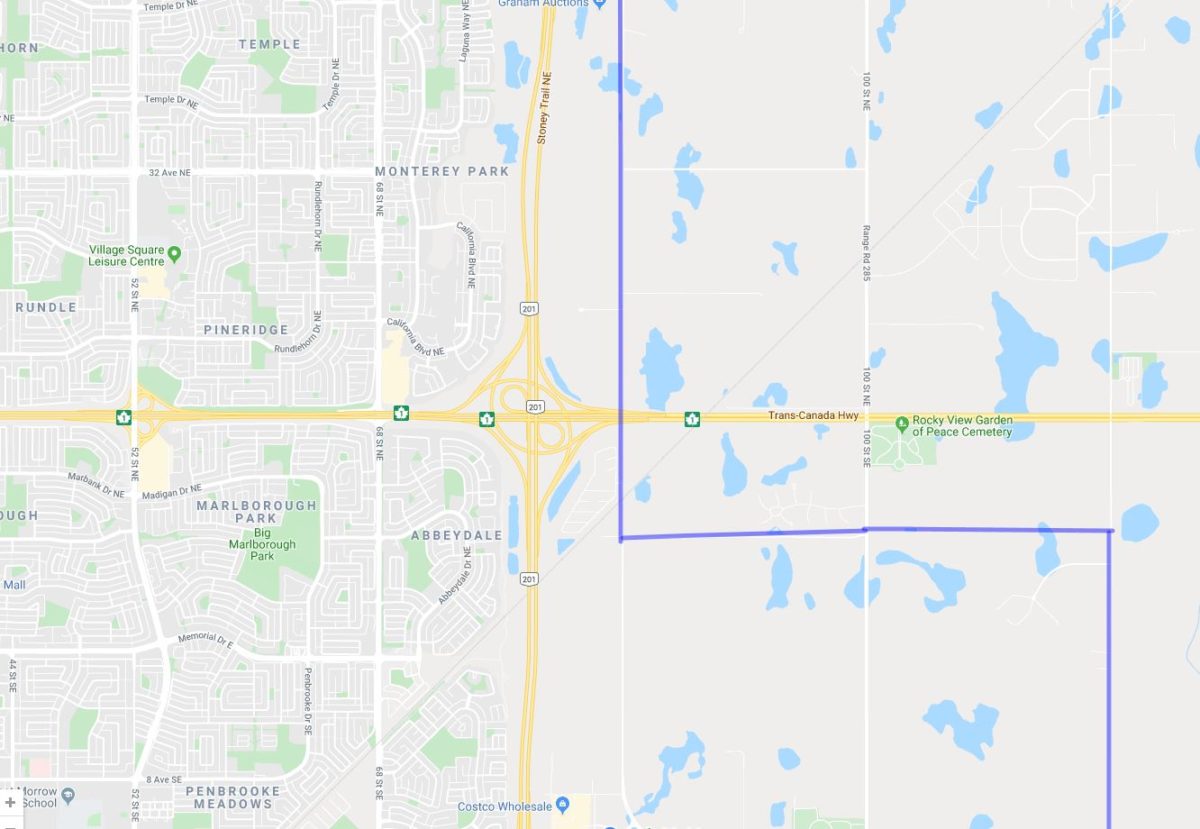
To access this on a desktop simply click on this link. This will bring up Google Maps, as below.

The YYC2020 area shows up as a lighter area bounded in blue.
To facilitate easier access in the future you can choose to bookmark this location in your browser.
To access on a smartphone/tablet the process is similar, and there are probably several ways to do it. First ensure that you have the Google Maps app installed on your smartphone.
The way I have found most convenient is to generate an email with the link embedded. You can then click on the link in the email to get the map, as below. As with the desktop version you can then zoom in and out. If you are in the field you can immediately check to see if you are in the city limits or not. If you are at home and checking to see if a location you have already birded at is inside the city limits, just compare your location from the eBird location map to this boundary map.
I have created an email subfolder YYC2020 on my phone with this (so far the only) email in it so that I can rapidly find the relevant email and click on it.
You can also set this up as a favourite in your smartphone browser. I think this is more complicated, and how to do it depends on your actual smartphone and preferred browser. There are too many options to describe each one here.
Google Earth Tool
This requires that Google Earth Pro is installed on whichever device(s) you are going to use. It also requires setting up the City boundary as one of “My Places” in Google Earth.
The City boundary is defined in a Google Earth add in file named “Calgary City Boundary.kml”. This is available on the Nature Calgary YYC2020 webpage.
To access this tool on a desktop :
- Download the kml file from the Nature Calgary website and save it in a convenient folder on your desktop. The file link is at the bottom of this page on Nature Calgary’s site.
- Open Google Earth Pro
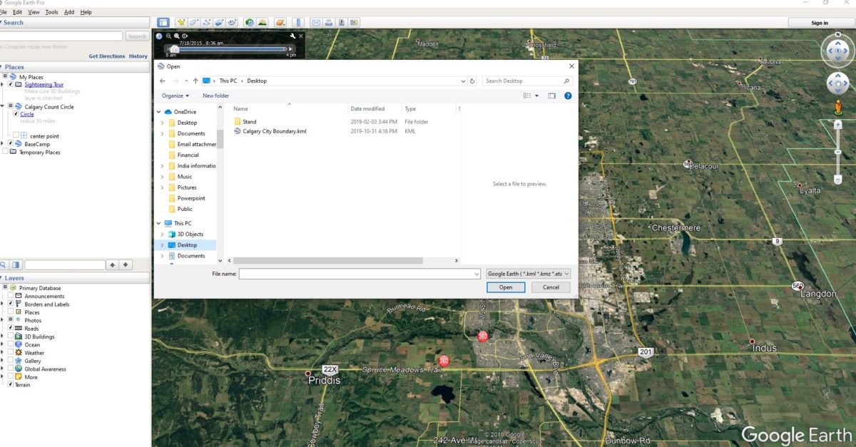
- Use file open and navigate to the location where you saved the kml file

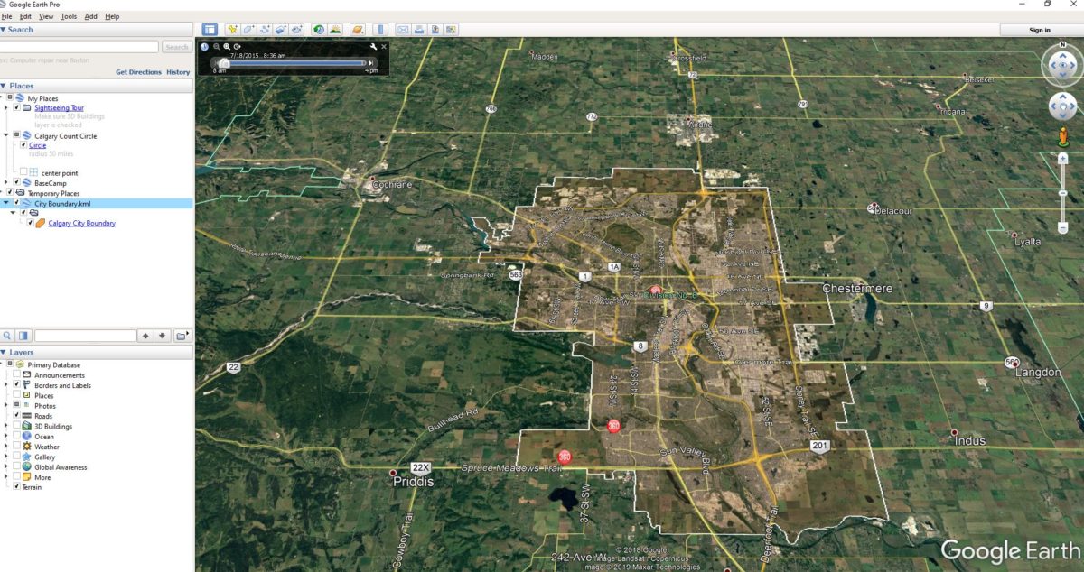
- Open the kml file and you will see the Calgary City boundary saved under “temporary places” in the menu on the left. You will also see a view showing the city limits overlaid with a brown colour. The precise view you will get depends on exactly which layers you have switched on in the lower part of the left hand menu.

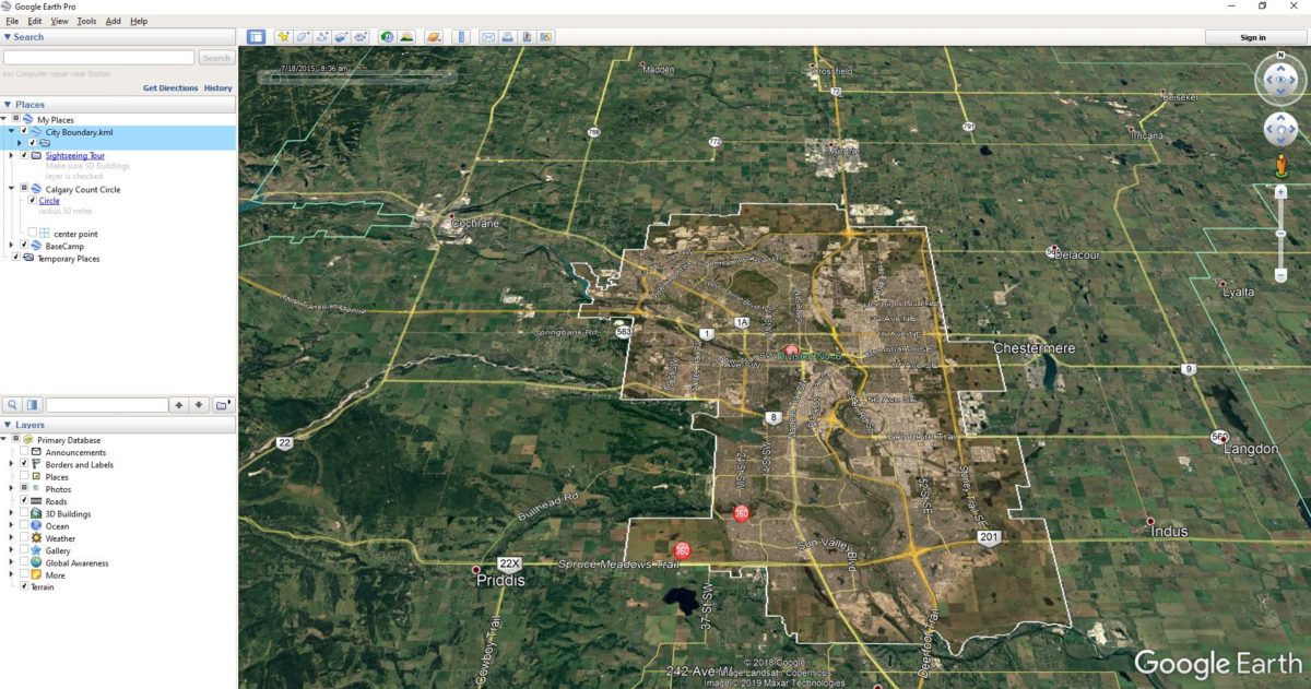
- Next, to ensure you see this the next time you open Google Earth just drag the City Boundary.kml folder up in to the “My Places” folder.

- That completes the set-up.
- Next time you open Google Earth simply click on the “Calgary City Boundary” link under My Places.
To set it up on a smart device the procedure is somewhat similar.
- Install Google Earth Pro on your smart device
- Install the kml file on your smart device
- There are a number of ways to do this
- If you already have the file on your desktop then save the file to a cloud location that is accessible to your smart device. Typically iCloud or Onedrive.
- Then download the file from the cloud location to your smartphone .
- Now open Google Earth (Pro) and open the “Projects” drop down menu from the three bar menu at top left.
- Press “open” and then “Import kml file”
- Browse to where your kml file is located. The iCloud screenshot below is one example
- Tap on the relevant file
- Bring it in to Google Earth (by tapping)
- You will now see the city boundary as a brown overlay
- If you want to check your own location then tap the three white dots at top right.
- Next tap my location at the bottom, and you will see your location.
- Note that unlike Google Maps Google Earth does not continuously update your location. If you move and want to check again then you have to reset your location
- If you do not have access to the file on a desktop then access the file on the Nature Calgary website from your smart device and save it to your smart device. Then follow the same steps described above.
If you have any questions about the challenge contact:
- Howard Heffler: hheffler[at]shaw.ca
- Andrew Hart: andrewhart[at]shaw.ca
- Bob Lefebvre: wbird7[at]gmail.com
- Gavin McKinnon: gmckinnonbird[at]gmail.com


